We’ve now been outside of Phoenix in Gold Canyon for a week. In retrospect, we can’t really remember why we decided to stay on the outskirts of such a large city – it is not our usual traveling style! I think it is because we looked at the state map and decided we should camp in the north (Black Canyon), the middle (Phoenix) and the south (Tucson), not really thinking that much about the population density. The city itself is the 5th largest in the country with a 1.6 million population and an incredible 500+ square mile footprint. (Boston by contrast has a footprint of 48 square miles, one-tenth that of Phoenix.) The metro area (which I guess we would be considered to be in) has a population of over 5 million. The urban highways (of which there are MANY) have up to 9 lanes and lots of traffic congestion. As a result, we have avoided going into the city for entertainment and have instead turned to the mountains that surround the city.
A new very different kind of “neighborhood”
We are staying at Gold Canyon Golf and RV Resort. It is very different than any other place we have stayed or are scheduled to stay at. It is primarily a retirement resort with a few (only 7 out of 600+) spaces for “short term” RVs. The long termers come and stay in their large RVs (they don’t accept RVs under 26 feet, so we just made it under the wire with our 27’ trailer!) or small 600 SF permanent dwellings for most of the winter.


The mountains behind our neighbors are the Superstition Range
Because almost all our neighbors are long termers, the social vibe of the neighborhood is very different. When you are in a typical RV park, everyone is traveling – from somewhere and to somewhere. It is easy to trade travel stories and build social relationships quickly. In a community like this one, you are a bit of an interloper in an already well-established set of social relationships. The residents have their routines and patterns, and those are very different than ours. It is not that people aren’t nice, but with a few exceptions they are distant. That makes sense to us, given the set up. We’d probably feel that way if we had RVs coming and going next to our house! It did convince us, however, that it is not the kind of vibe we would seek out and as a result, we decided to head out to Tucson (to a KOA RV resort full of travelers like us) a week early.
Copper Country
We took a drive into the mountains on Route 66 that heads East out of our resort. We were going to do a loop around the mountains, but it turned out that there were still lots of roads closed because of severe flash flooding that has hit the area in the last two months (not unlike the devastation we saw in Ruidoso). While the views were great, what ended up being most interesting to us were the massive open pit copper mines. Copper is a critical mineral, particularly in an era of “mass electrification”. Turns out that 70% of the copper produced in the US comes from Arizona, with the Miami/Globe AZ region being one of the historically largest sources. As you can see from the picture, the sheer scale of the mining process is mindboggling.
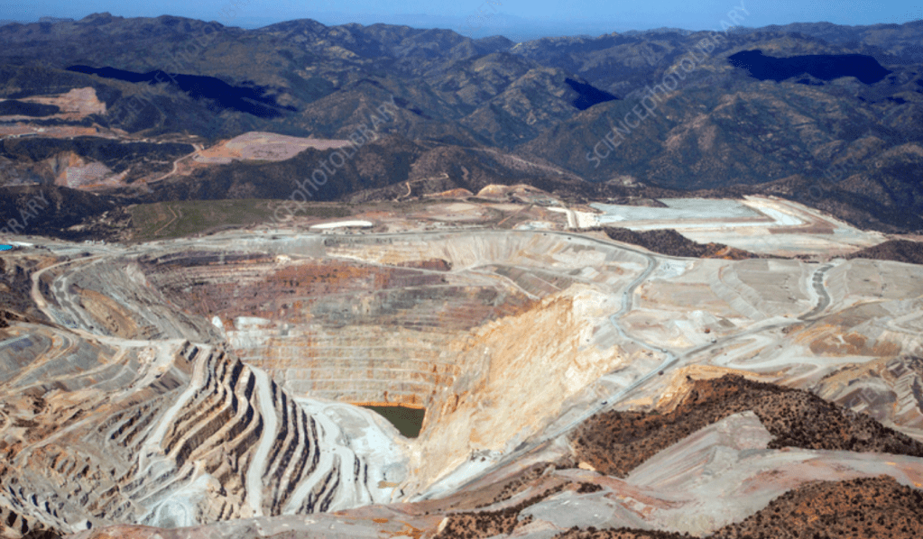
Aerial view of Miami AZ open pit copper mines
Many of the mines are now inactive, but one of the largest reserves in the US is under Superior AZ, 20 miles from Miami. Owned by the Resolution mining company it is estimated to contain 1.8 billion tons of ore and could produce 40 billion pounds of refined copper. The Resolution deposit mining process would be amazing in its own right, since the deposits are up to 4,000 to 6,000 feet below the surface open pit mining impossible. To get to this ore requires using what is called “block mining”, a technique where they hollow out a huge hole below the ore deposits and the set off blasts that result in the ore falling into the hole. The crushed ore is then transported to the surface through large tunnels.

Next time we flick a switch, I guess we should ponder what it takes to get those copper wires that transport the electrons that heat and light our homes.
Hiking in the Superstition Mountains
I hadn’t done a real mountain climb since leaving Tamworth over 6 weeks ago. I was nervous about my leg strength but decided to give it a try. After trolling through All Trails, I settled on a hike up the Three Sisters for which the trailhead is about 20 minutes from our trailer. All Trails pegged it at 7.0 miles and 2,500 feet of vertical. (Interestingly, here is what a local hiking site said about it: “Three Sisters Summit is one of those hikes you’ll likely only want to do once. It is steep, strenuous, and covers a good amount of milage. It isn’t technical by any means…it just is that steep.” This made me think that they must have different standards out here for what qualifies as “steep and strenuous” since almost all the 48 4,000 footers in the Whites are this high or higher.)
My 7-mile 2,500 foot hike eventually turned into a 10.5-mile 3,200 feet hike – not exactly what I planned for a “training” hike! The first glitch was that the trailhead parking lot was full and I had to go to an overflow parking area that added 2 miles to the roundtrip. The second was that I missed the turnoff to the Three Sisters trail and ended up hiking to the “Wave Cave” along with what seemed to be half of the population of Phoenix. I kept wondering why all these teenagers with no hiking gear would be going on a “steep and strenuous” hike, but – DUH! – it never occurred to me to check the All Trails app. The trail ended at the Wave Cave and there was no way to bushwack to my trail, so I had to just loop back to the missed turn and start over. This added 1.5 miles and 700 feet.
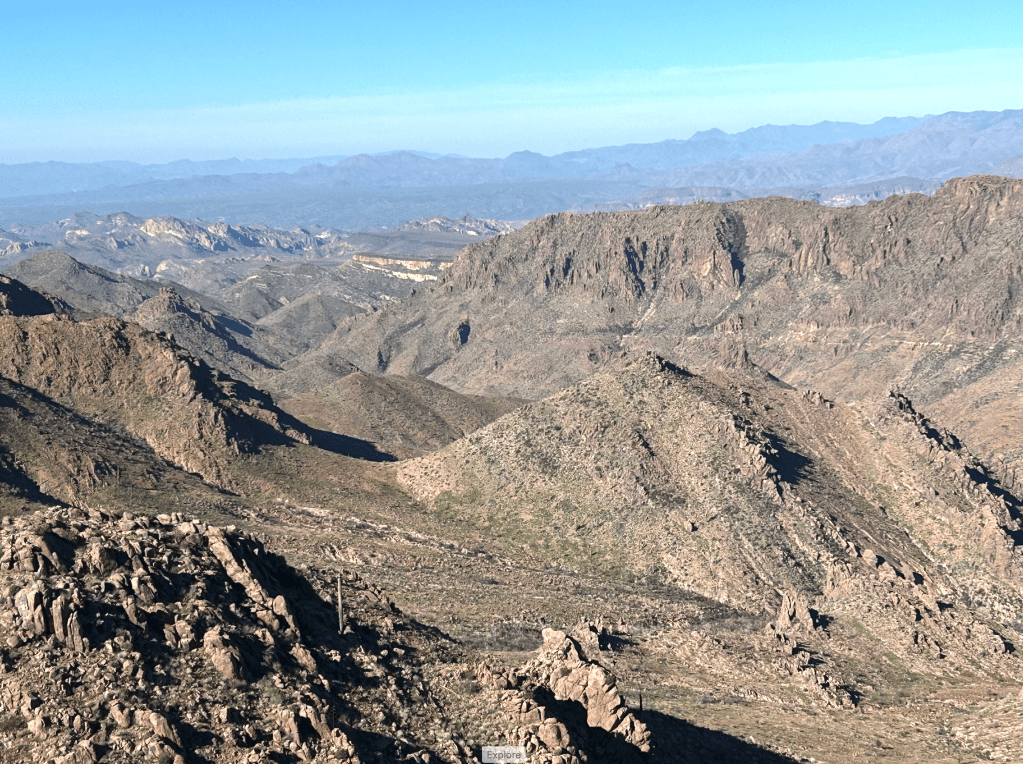
Once I got on the right trail, it was totally worth it. The trail was delightfully steep and reminded me of New England hiking. The views were stunning and I only passed one other hiker is 6 hours. As a bonus, when I got done the sun was going down and there was a delicious desert sunset as I drove out of the park. Great day in the desert mountains!
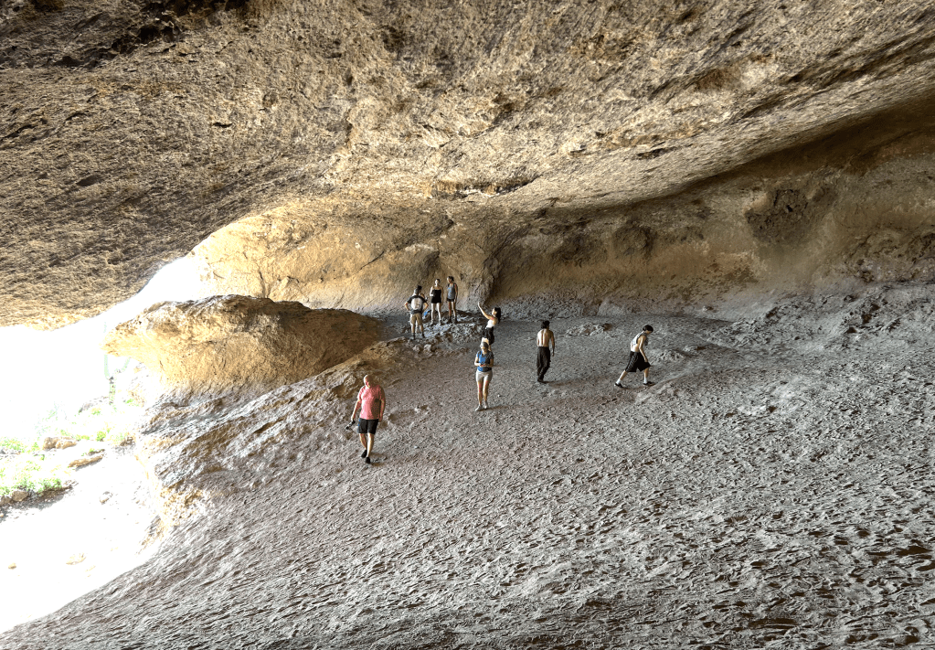
The Wave Cave

The hiking trail went up through this canyon
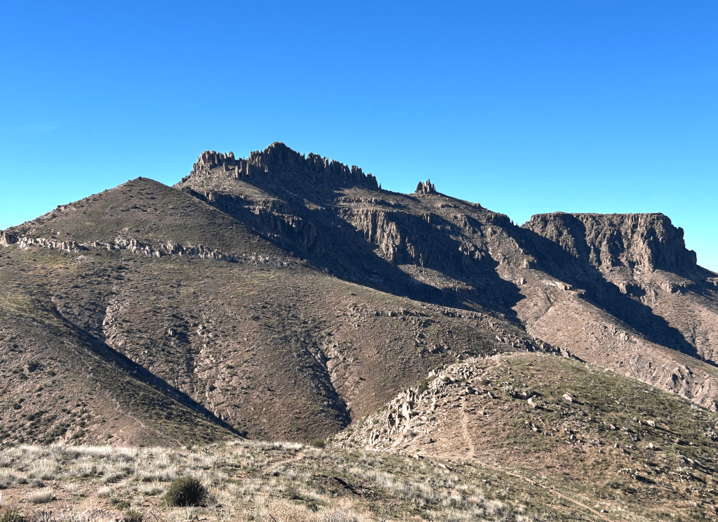
My next destination — Mount Superstition

This trail made me feel at home!
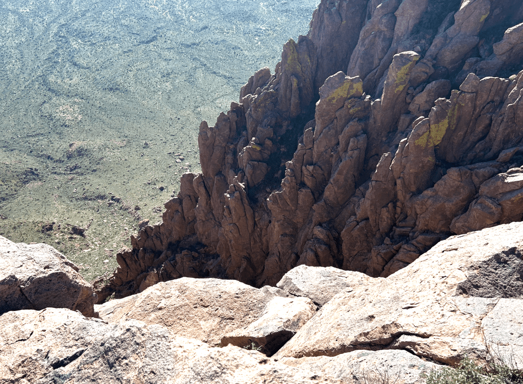
I couldn’t get any closer to the edge — my feet would start aching and I would imagine passing out and falling down the cliff...
Hiking footnote – endless opportunities for trailside laceration
One thing I ended up learning hiking in the desert environment is that there are a totally different set of laceration opportunities than hiking in norther environments – primarily from the cacti that bound the trail. Since I am on blood thinners (yes – carrying massive amounts of blood clotting and first aid equipment!) I must pay attention to this. One habit I had to change is that going up or coming down steep pitches I rely on the trail side trees for support. (I find myself thanking them a lot for this help.) This is not a good idea what the trail side structure is a saguaro cactus. I ended up stopping my hand in mid-air many times as I realized it was about to get pierced by nasty spikes. Once you learn to respect the cacti, you can start to think about them as another set of trail friends – to be enjoyed at a bit of a distance.

Don’t grab the saguaro!

Cactus skeletons

You must be logged in to post a comment.