We are just finishing two weeks in another amazing and unique desert environment — the 600,000-acre Anza Borrego Desert State Park, 1.5 hours south of Palm Springs and two hours East of San Diego. It is bounded by multiple high mountain ranges.
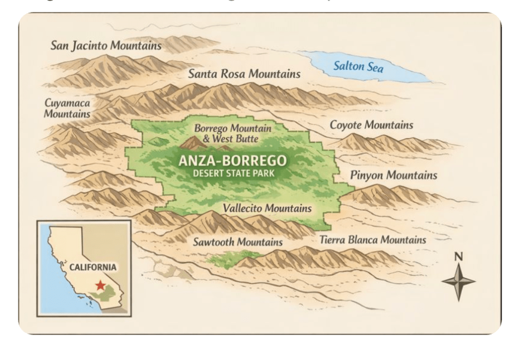
Even though they are only 80 miles apart, the Anza Borrego desert and the Joshua Tree desert are very different ecologies. The former is 200 to 3,000 feet below sea level, whereas the latter earns its “hi-desert” name because it is 2,000 to 5,500 feet above sea level. Anza Borrego is much hotter and even drier (could that be possible??) than Joshua Tree – having some years with only 2″ of rain, and frequent temperatures of 120 F or more. Its landscape is also more barren, with a lot less vegetation and plant variety. There is an austerity and sweeping vastness to the Anza Borrego desert that makes it fascinating and delightful to explore.
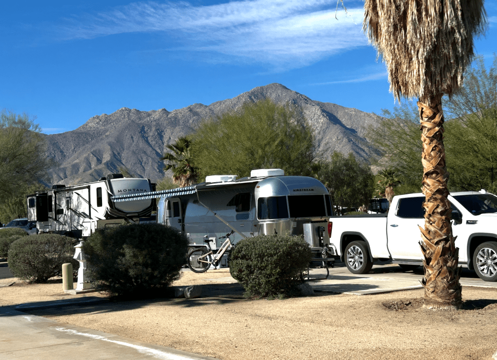
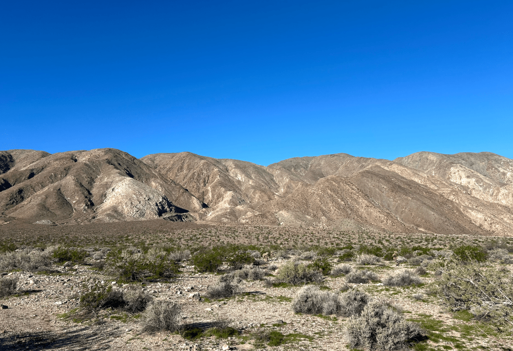
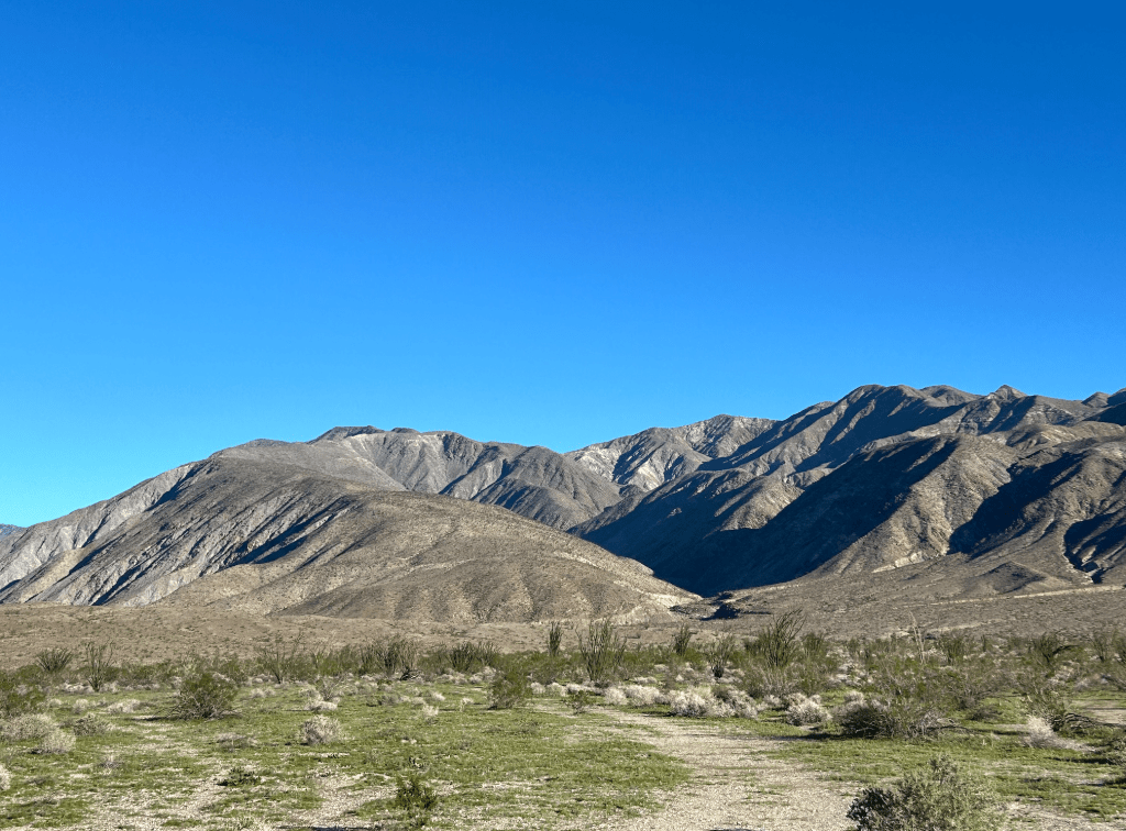
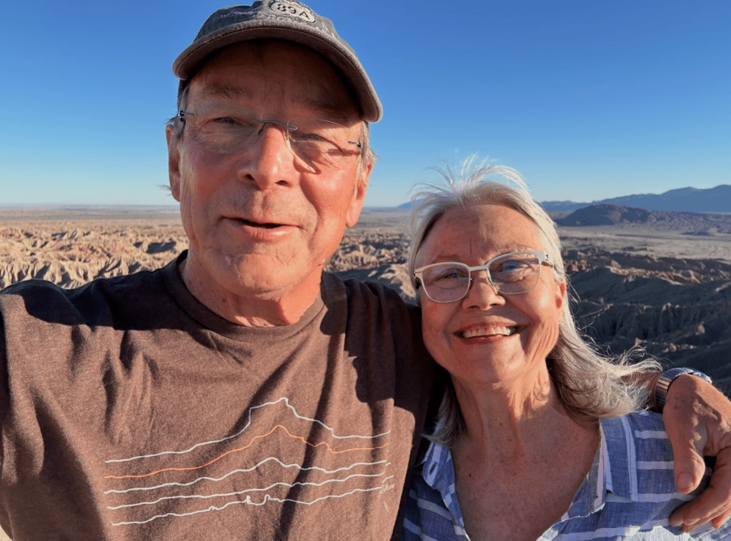
Our Mountain View
Borrego Springs has a small permanent population (3,000 – barely larger than our hometown of Tamworth) but is a vibrant tourist community with a peak winter population estimated at 10,000 to 15,000 and as many as 500,000 visitors a year. The visitors come for many things – amazing weather (we have had 12 days of sun with lows in the upper 40s and highs in the upper 70s and lower 80s), gorgeous scenery, great biking and hiking, good shopping amenities, and a vibrant desert art scene. While we were here, Borrego hosted the Borrego Springs Film Festival that filled our RV park to the brim with visitors.
Borrego Springs was the second city globally to be certified as a “Dark Sky Community” by DarkSky International in 2009. As a result of their controlling of light pollution, plus the surrounding mountains, the starry nights beckon you to wander out from the trailer when you get up to use the bathroom at night! The stars are brilliant and you can clearly see all the constellations and the Milky Way. It is hard to look at these creatures of celestial creation and not be overwhelmed by a sense of mystery and awe. It puts our flash-in-the-pan life spans in context too see light that has traveled for millions of year at the speed of light to get here. it makes it hard to stick with our typical earth-centric view of the universe when you think of it that way.
Delicious “Sky Art“
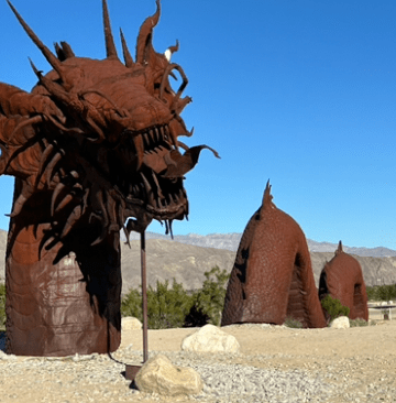
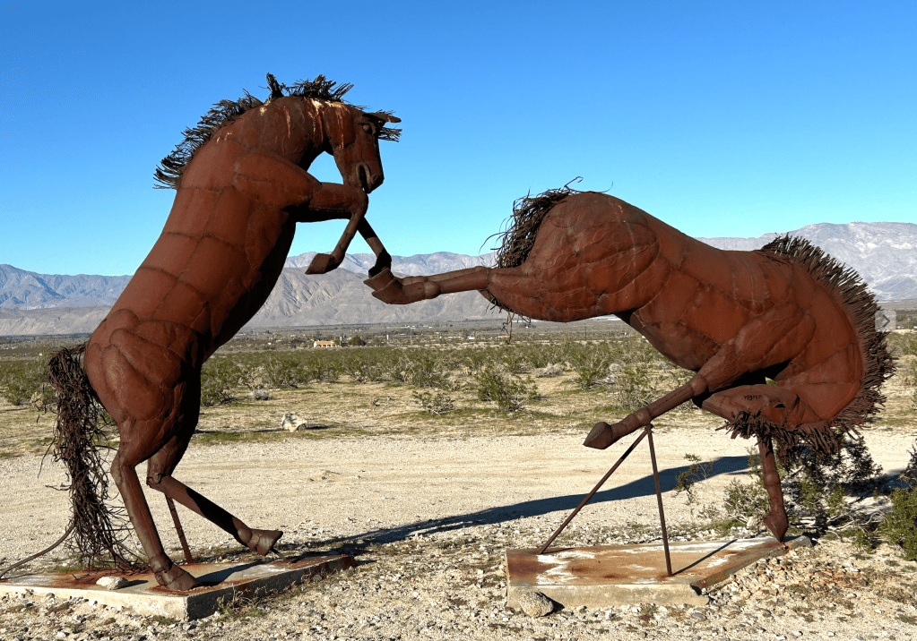
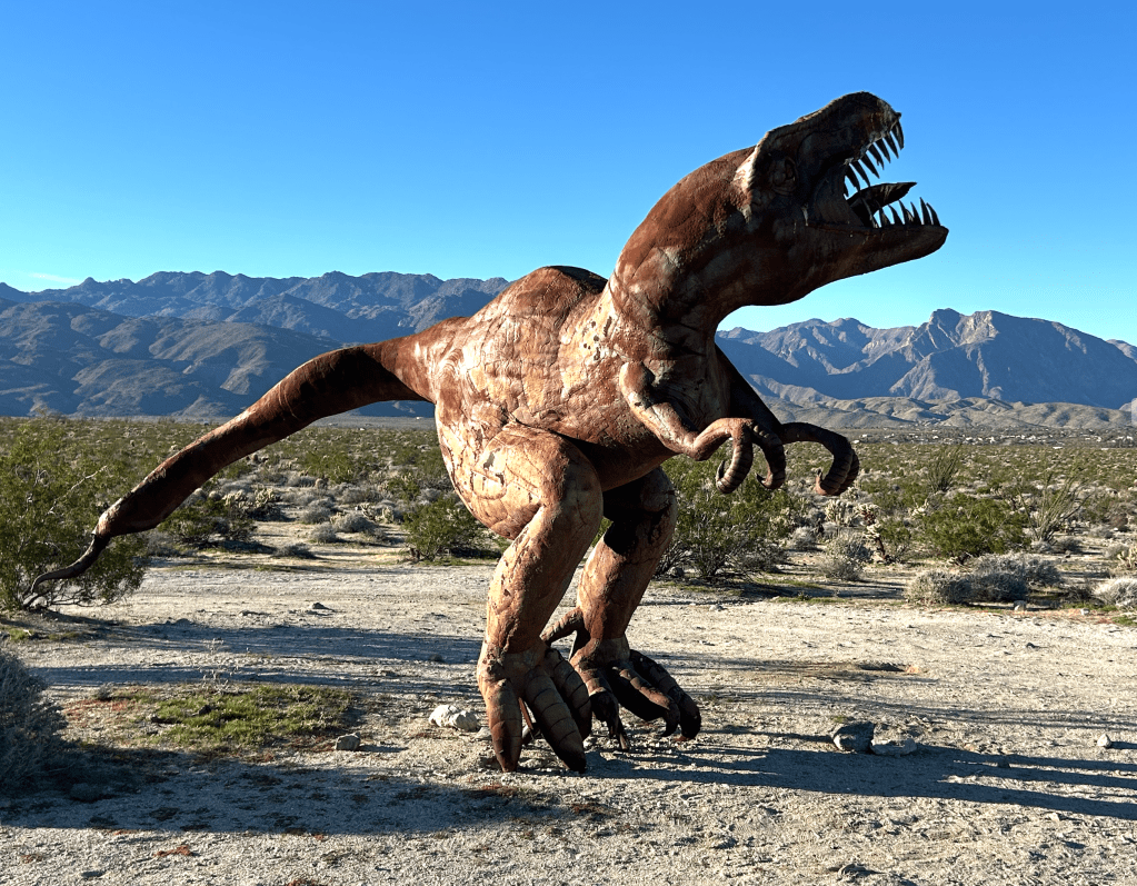
Borrego is also home to a fascinating collection of Sky Art, a collection of 130 large-scale, free-standing, metal sculptures produced by artist Ricardo Breceda. The collection was the inspiration of Dennis Avery, the late landowner of Galleta Meadows and a long-time resident of Borrego Springs. The sculptures are spread over more than 1,500 acres of land and are all accessible by car. We, of course, toured as many as we could find! Some fun pictures are below. The serpent, tyrannosaurus and horses were our favorite. Their rusted metal exteriors make them look like they definitely belong in the desert.
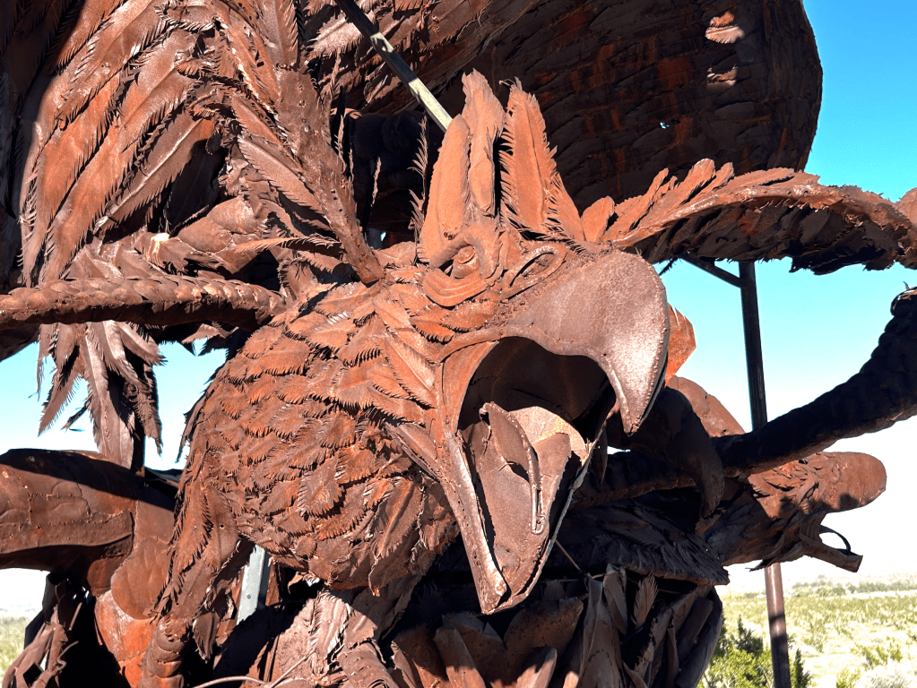
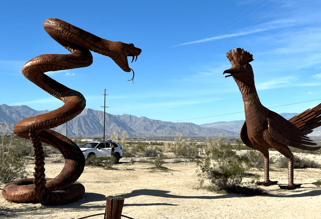
The Roadrunner and Rattlenake Duke it Out (The roadrunner always wins…)
Desert Blooms
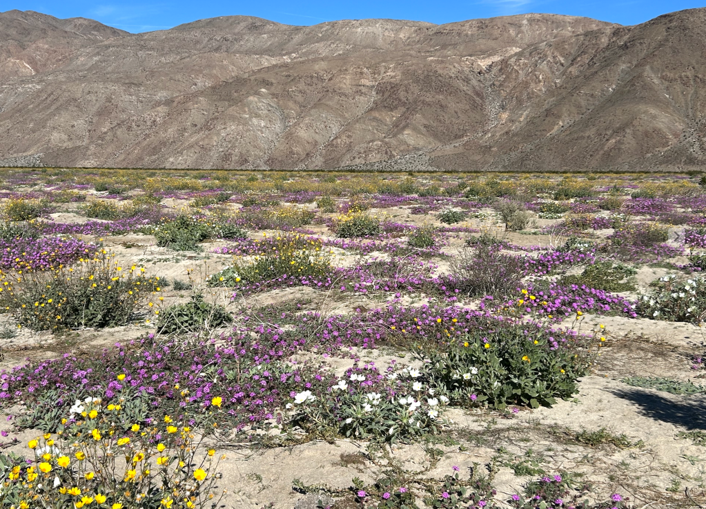
Another tourist attractor is the occasional desert flower blooms that are triggered by winter rains. “Super blooms” cover the desert with an intense carpet of multi-colored flowers and only happen when there is just the right amount of rain, followed by warm temperatures, and preceded by drought to kill weeds. We didn’t see a super bloom (although there were rumors that one might be about to happen) but did get to see a smaller example. What is amazing is the idea that these plants can hang out for the entire year with less than four inches of rain and be ready to burst forth on a moment’s notice. The mysteries of nature are truly endless!
Our Bloom
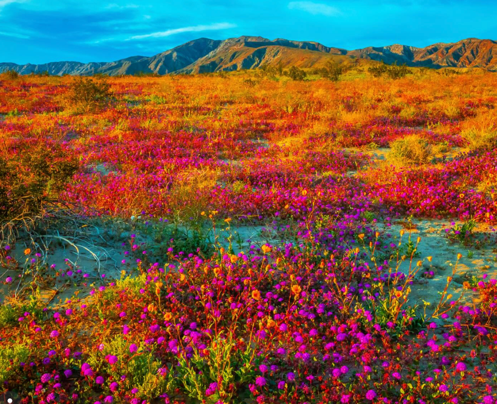
What a “Super Bloom” Apparently Looks Like (With what appears to be a bit of digital color enhancement…)
The Hikes That Were, and the Hike That Wasn’t
Despite the plethora of mountain ranges surrounding us, there is a relatively small number of good hikes within a reasonable driving distance of our RV park. (I concluded that the steepness of some of the pitches and the low population density were probably the reason for this.) Nevertheless, I was able to do two great hikes, both of which had jaw-dropping views, which start when you step out of the truck. The trails were well maintained, they have lots of switch backs, and once you get up some vertical, the temperatures are pleasant.
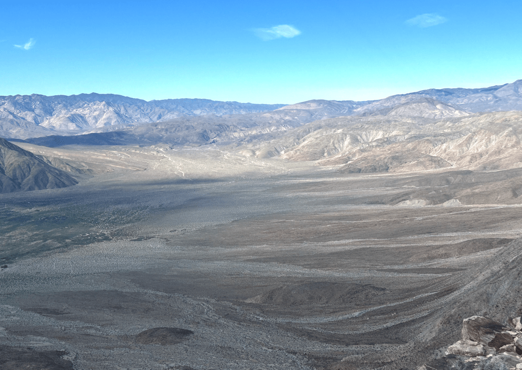
Coyote Peak overlooks the Clark Dry Lake, an expansive, flat, and sandy lakebed that every once in a while, can temporarily flood after heavy rains. It was a low impact hike – under 6 miles and only 2,300 feet of vertical – with the added benefit of being a “private mountain” day hike – I didn’t meet anyone the entire time.
Coyote Peak From the Trailhead
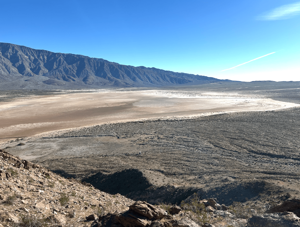
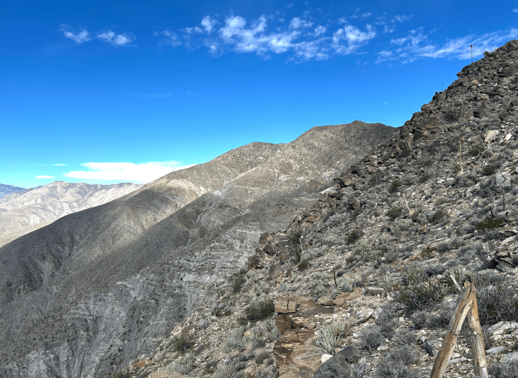
A View of the Dry Lake, and the Ridge That Was My Second Hike
A Nicely Meandering Trail
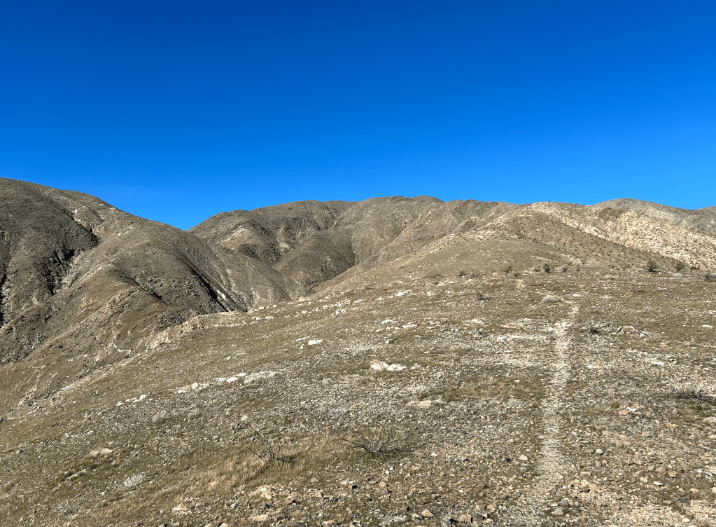
The Villager Peak trail is on the ridge exactly opposite the Coyote Peak hike. It was a bit longer (10 miles) and steeper (3,300 feet), but with even better views.
View of the Villager ridge trail on the left from the trailhead
Desert poetry, for sure!
Attack of the Jumping Chollas
While everything else on the Coyote hike went awesomely, I did suffer an unfortunate run-in with the Cylindropuntia Fulgida, also known as the “jumping cholla” cactus. Wikipedia does a nice job of explaining why these cacti have this name:
They call it “jumping cholla” because its easily detached, barbed stem segments break off and latch onto anything that brushes past, creating the illusion they “jump” or leap onto people, animals, or clothing. The plant doesn’t actually jump, but its loosely attached, spiny “pads” detach so readily and painfully that it seems as if they actively attack, making removal difficult.
This run-in led to a collection of 20-30 “barbed stems” embedded in my left hand. It happened fast – one of the “pads” got stuck on my right ankle above my boot. The stings are really nasty and felt all the world like I had stepped on a yellow jacket nest. I instinctively swept down with my left hand to swat them away (I have a bit of an allergy to bee stings that I must pay attention to, so the swell of panic was instantaneous). This, of course, resulted in me bringing back up a wad of cholla spines in the palm of my hand. Fortunately, I had procured a good pair of tweezers as part of my hiking equipment, which I used to extract them. It took about 20 minutes and was, of course, painful! The spines have barbs (think miniature porcupine quills) that make them hard to pull out. A bunch broke off and as a result, I was pulling remnants out for a few days.
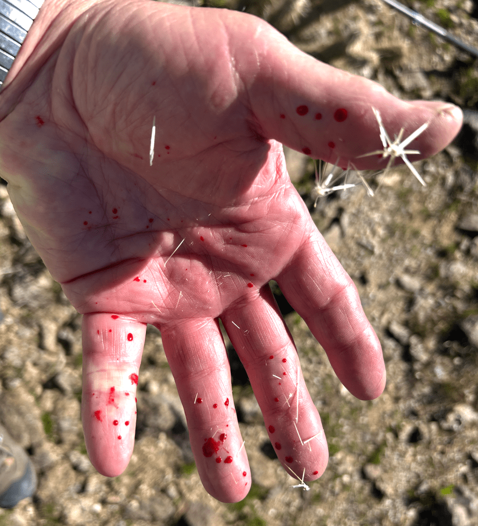
Every drop of blood is another spike…
Interestingly, I didn’t figure out how this attack actually happened until my second hike up the Villager Peak trail.
I thought the mistake I had made was that I brushed against a cholla plant next to the trail. I was miffed by this because I pay very close attention to avoiding them and couldn’t remember getting close enough to get spiked. Going up Villager, I figured out that this wasn’t the source of the problem. Instead, the problem was that the cholla drop their “pads” into the middle of the trail. I had stepped on one, which stuck to the inside of my boot (that can pierce the plastic and leather with ease!) and then brushed against my other leg.
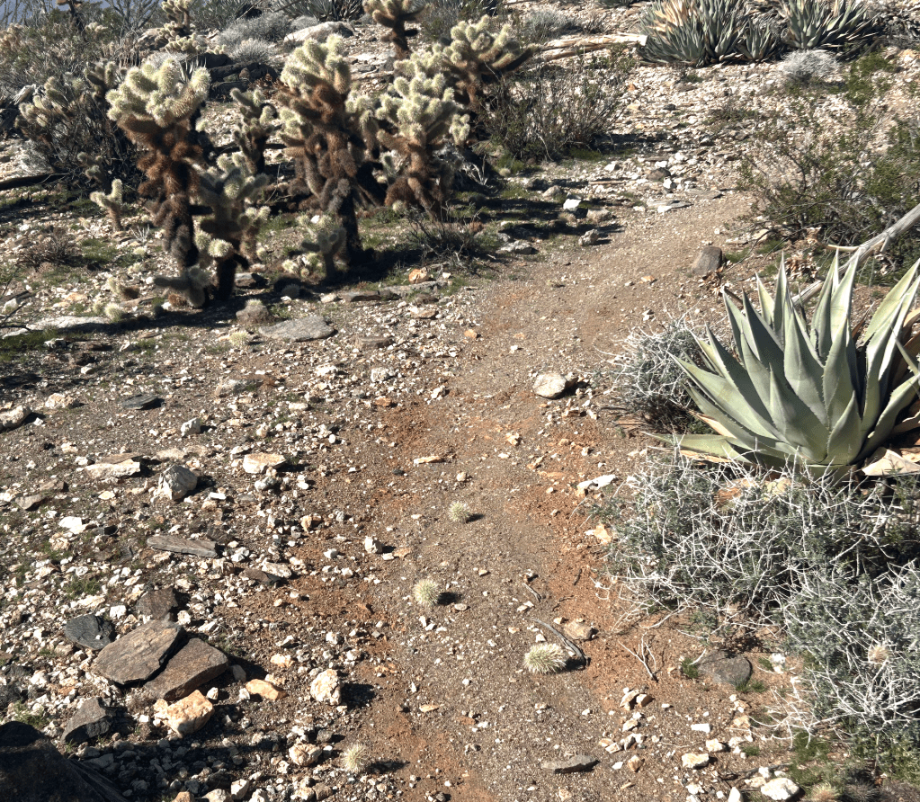
Chollas setting their land mines
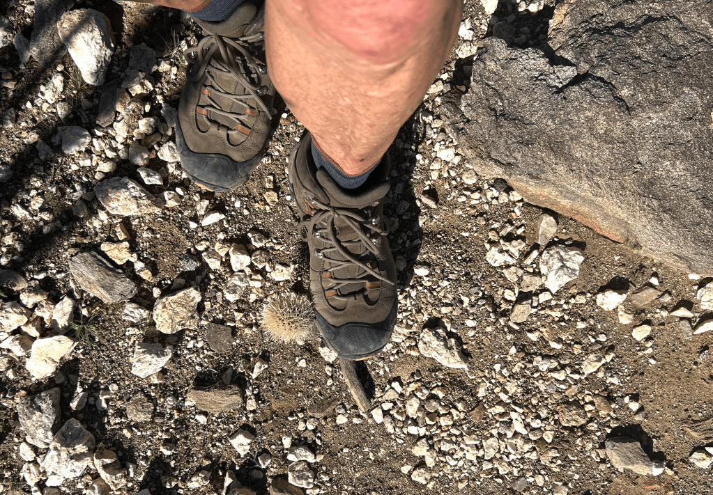
An unwanted hitchhiker!
Lesson learned! The rest of the hike, I obsessed on the cholla pads on the trail and not the plants.
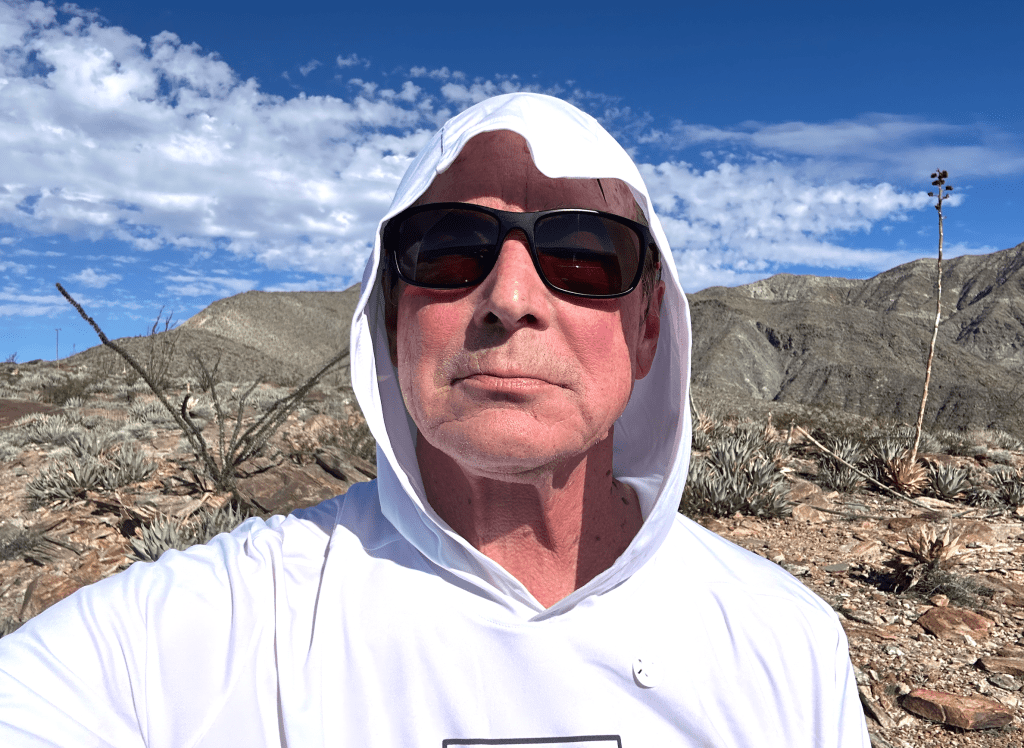
PS — I became a great fan of the sunshade hoody for desert hiking that I bought at the Anza Borrego Park store, and was able to dispense with the hat. (PSS — Michelle did note when I got home my failure to remove the XL sticker…)
The Hike That Wasn’t
The first hike that was on my AllTrails list was one I ended up not doing, which is a rare event for me. (Who, me stubborn??? Can’t be!) The hike was attractive because it is right behind our campground, and it fit my basic stamina parameters – 7.5 miles, 3,100 feet vertical. I even went to check out the trailhead while taking our pups for a walk in the campground it was located in. Easy to find and good parking. AllTrails itself had the following review, with a few provisos:
This hike will beat you up as it is off trail in an area of cactus and agave. This hike is through the canyon and basically straight up from there. You gain about 1500-2000 ft in a mile or so. This is one of those hikes you may only want to do once.
Of course, being a glutton for punishment, this made the hike all the more attractive to me. (In the Three Sisters hike I did in Gold Canyon had a similar review and ended up being one of the best hikes I have done so far on the trip: “Three Sisters Summit is one of those hikes you’ll likely only want to do once. It is steep, strenuous, and covers a good amount of milage. It isn’t technical by any means…it just is that steep.”) Fortunately, I read the Indianhead hiker reviews before I started the hike. The few that captured my attention were these:
“This is not a hike. It is a fun climb with a lot of Class 3 scrambling.“
“Its literally as stated by the few reviewers who made it – no trail. Just you and the steep savage mountain of suffering.“
“If you hate yourself this is the perfect hike for you!“
A lot of the reviews were by people who never made it to the summit or took seven hours to get there – an average of 0.5 miles an hour hiking. And many of the hiker pictures were of climbers with helmets on and some emergency ropes. The on-line definition of “Class 3 Hiking” reinforced the risk:
Moderate scrambling on steep, rocky terrain where you consistently use your hands for upward movement, but without technical climbing gear; a fall could cause serious injury but isn’t usually fatal, though helmets are recommended due to exposure and loose rock.
So, for the first time that I can remember, I punted on a hike and was very happy about it… although I am quite sure that if we ever return to Borrego Springs, I will come with a climbing helmet and try that hike!
Indianhead Mountain in the morning sun. (The not-hiked trail is on the other side.)
End Note – A Preview of “Western Water Weirdness”
We don’t have time to get into it in this blog, but the Borrego Springs experience reinforced the complete craziness of how western states use their water resources. We were struck by this driving across New Mexico and Arizona – through tens of thousands of acres of thirsty crops – alfalfa, corn, cotton, fruits, nuts, you name it – in deserts that get less than 10 inches of rain a year. Where does the water come from? From the Colorado River and aquifers that took 10,000 years to fill up and are being drained at a totally unsustainable rate. In Borrego (remember they have some years with less than 4 inches of rain…) there are large tracts of citrus, grapes, fruits, squash and other crops. Agriculture consumes 70% of the town’s water. The city’s new Groundwater Management Plan seeks to reduce water consumption by roughly 75% by 2040, addressing a critical overdraft of about 13,000 acre-feet per year. This plan, under a court-approved Watermaster Board, includes a 50% cut in usage in the first 10 years, impacting agriculture and golf courses. The goal is to reach a sustainable annual yield of 5,700 acre-feet to ensure the community’s survival. Without this change in consumption, it is clear that they will simply run out of water and the town will die.
More to come on this topic, as we move further into a state that is at the forefront of this dilemma.
Off To The California Coast
Tomorrow, we leave three months of desert terrain and head to the California Coast of Avila Beach. It promises to be a very different kind of “Grand Adventure”.
Until then, love to you all.
John, Michelle, Bob, Raven & Wren

You must be logged in to post a comment.